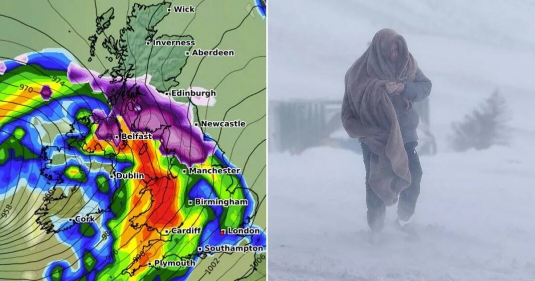
The official naming of Storm Éowyn by the Met Office has prompted the release of new maps showing a significant weather system that could result in five consecutive days of snow across the UK.
For Friday, the national weather agency has issued “danger to life” wind warnings in anticipation of the impact from Storm Éowyn, with wind speeds potentially reaching up to 80mph in various regions except the south-east of England.
Further alerts from the Met Office are likely due to the expected heavy rain and snowfall. Weather forecasts from WXCharts indicate rain moving through Northern Ireland, Wales, and southern parts of England on Thursday, while snow is predicted in northern England and the Scottish Highlands, with rural and elevated areas possibly experiencing snowfall at a rate of approximately 3cm per hour.
The weather disruption is anticipated to intensify early Friday, with projections showing heavy rain hitting Wales at a rate of 8mm per hour around 3am. Simultaneously, snow flurries at a rate of 5cm per hour are expected in Northern Ireland, northern England, and southern Scotland, leading to temperatures dropping to as low as 2C to 3C in some parts of England, Wales, and Northern Ireland, and -2C in the Scottish Highlands.
Saturday is forecasted to be a relatively calmer day overall, although light snow is expected to persist in western Scotland, with additional snowfall projected for North Wales and northern England around midday, potentially affecting cities like Manchester and Liverpool.
WXCharts data suggests ongoing snowfall in northern England and Scotland during the early hours of Sunday, while heavy rain is anticipated in Northern Ireland and South Wales later on Sunday, with rain rates reaching around 10mm per hour in South Wales.
Monday is expected to be the final day of the snow spell, with intense snow flurries of up to 10cm per hour forecasted for rural parts of southern Scotland. Rain is more probable for most regions, with significant downpours expected across England, Wales, and Northern Ireland early in the morning.
According to the Met Office, the heaviest rainfall accumulations are likely in western Scotland, England, and Wales, with possible snowfall over high ground in the northern regions, particularly over the Scottish mountains.
Met Office’s Deputy Chief Meteorologist, Mike Silverstone, highlighted the disruptive weather expected from Storm Éowyn, with gusts exceeding 80mph forecasted for specific areas, including parts of Northern Ireland, northern England, northwestern Wales, and western Scotland. He emphasized the importance of staying updated on the evolving forecasts as the storm approaches.
At Reach and across our entities , information collected through cookies and other identifiers is utilized to enhance user experience, analyze site usage, and deliver personalized advertisements. Users can opt out of data sharing at any time by clicking the “Do Not Sell or Share my Data” button at the bottom of the webpage. By using the website and services, users agree to the use of cookies and consent to the practices outlined in the Privacy Notice and Privacy Notice.

